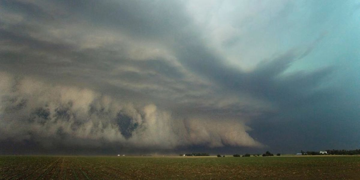
New Jersey residents are being urged to prepare for a fast-moving and potentially dangerous weather event Thursday, as forecasters warn of severe thunderstorms capable of producing destructive wind gusts later in the day.
The setup began early Thursday with unusually warm and breezy conditions statewide, driven by a strong pressure gradient between a low-pressure system to the north and a powerful high-pressure dome parked offshore near Bermuda. That clash is expected to fuel scattered storms as a cold front sweeps through the region.
Forecasters say the window for severe weather runs roughly from 1 p.m. to 8 p.m., with damaging wind gusts identified as the primary threat. While the statewide risk level was initially rated higher Thursday morning, it was downgraded slightly by early afternoon. Even so, some storm cells could still generate gusts as strong as 60 to 70 mph, according to private weather forecasting services tracking the system.
Ahead of the storms, the entire state is dealing with blustery, gusty conditions, with sustained winds reaching 15 to 25 mph and gusts up to 40 mph throughout the day. Temperatures are also climbing into the upper 80s and low 90s, with humidity pushing the heat index into the mid- to upper 90s in some areas.
Along the coast, the combination of strong winds and surf has triggered a high risk of rip currents at the Jersey Shore today, a hazard officials are warning beachgoers to take seriously.
Relief is expected Friday, as the front clears offshore and brings calmer, cooler conditions with highs back in the 80s. The rip current threat is also expected to ease to a moderate level.
The weekend looks mostly dry and sunny, though another round of unsettled weather may be on the way. Forecasters are already watching a system that could bring widespread rain and thunderstorms back into the state Monday afternoon and evening, though the exact path remains uncertain.