WICHITA, Kan. — A dangerous two-phase severe weather event is set to unfold across eastern Colorado, western Kansas, and northern Oklahoma on Tuesday, June 23, and the window to protect your property is closing fast.
The Storm Prediction Center has issued a Level 2 of 5 severe risk for the region, and this one comes with back-to-back threats that shift from very large hail in the afternoon to widespread damaging winds overnight.
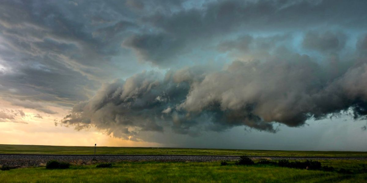
The Afternoon: Lone Storms, Massive Hail
The first threat arrives during the afternoon hours as isolated supercells fire off the high ground across eastern Colorado and western Kansas. Because these storms remain discrete — meaning they are not yet organized into a line — they have the atmospheric room to grow extremely tall and produce very large hail.
This is the most dangerous window for vehicles, livestock, and anyone caught outdoors. Residents across eastern Colorado and western Kansas are urged to move vehicles under cover now, before these storms develop. Once hail begins falling, it will be too late.
Evening Into Overnight: Storms Merge, Winds Turn Destructive
As the afternoon wears on, those individual cells are expected to consolidate into a single organized line that drives south into Kansas and northern Oklahoma through the overnight hours. When storms shift into line mode, the primary threat changes from hail to damaging wind gusts strong enough to down trees and knock out power across wide areas.
Communities along the Denver-to-Wichita corridor face the highest exposure, with the risk zone extending into Tulsa and Oklahoma City. A broader Level 1 risk surrounds the core zone, reaching north into Nebraska and the Dakotas and east toward Kansas City, Columbia, and Springfield.
What You Should Do Right Now
The time to act is before the afternoon storms develop, not after.
- Move vehicles into a garage or under solid cover immediately
- Secure any outdoor furniture, equipment, or loose items
- Charge your devices and have a flashlight ready for potential overnight outages
- Stay weather-aware and monitor local alerts through the evening
The threat window runs from Tuesday afternoon through the overnight hours. Do not wait until storms are on radar to take action.