Southeast Michigan residents are being urged to prepare now as a powerful storm system threatens to unleash dangerous flooding conditions across the Detroit area beginning Wednesday afternoon and lasting through Thursday morning.
Forecasters are warning that widespread thunderstorms will intensify through Wednesday evening, with rainfall totals expected to reach between 1 and 2 inches across many communities — and some areas could see even more. The concern is not just the total amount, but how fast the rain will fall. Repeated rounds of heavy downpours are expected, giving storm drains little time to recover between bursts.
Much of Lower Michigan has been placed under a Level 2 out of 4 flash flood risk by the Weather Prediction Center — a rating that forecasters assign when flooding is considered a genuine threat to life and property, not just a minor inconvenience.
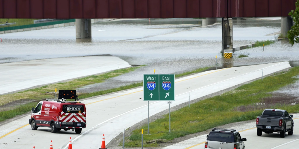
Urban areas face the highest danger. Cities including Detroit, Dearborn, Warren, Sterling Heights, Pontiac, Flint, Ann Arbor, Lansing and Jackson are all in the zone where streets can flood with little warning. Some of the region’s most heavily traveled highways — I-75, I-94, I-96, I-696 and M-59 — could see standing water during both the evening rush and overnight hours.
Drivers need to understand that just six inches of fast-moving water can knock a person off their feet. Two feet of water is enough to sweep away most vehicles. Flooded roads can appear shallower than they are, and the ground underneath may be washed out.
Wednesday evening commuters are especially vulnerable. If you plan to be on the road between 4 p.m. and midnight, expect delays and be prepared to find alternate routes.
Residents should charge their phones, enable weather alerts and have a plan if conditions deteriorate rapidly overnight.
Additional watches and advisories may be issued as the storm moves closer. Do not wait for a formal warning before taking precautions.
Do not drive through flooded roads. Turn around, don’t drown.
Stay with Sultana Insider for continuing updates on this developing weather situation.