A violent and dangerous severe weather system is rapidly intensifying over Wyoming, Colorado, and Nebraska today, placing millions of residents under a Level 3 of 5 Enhanced severe weather risk — while the rest of the country basks in some of the most pleasant conditions seen so far this summer season.
What is happening in the danger zone right now
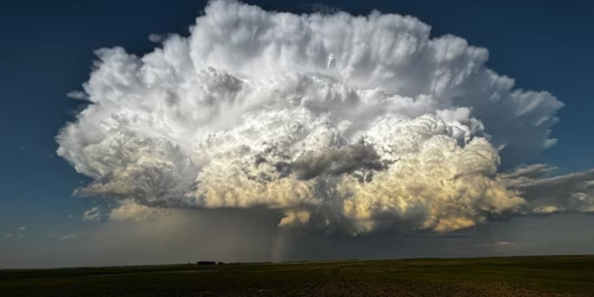
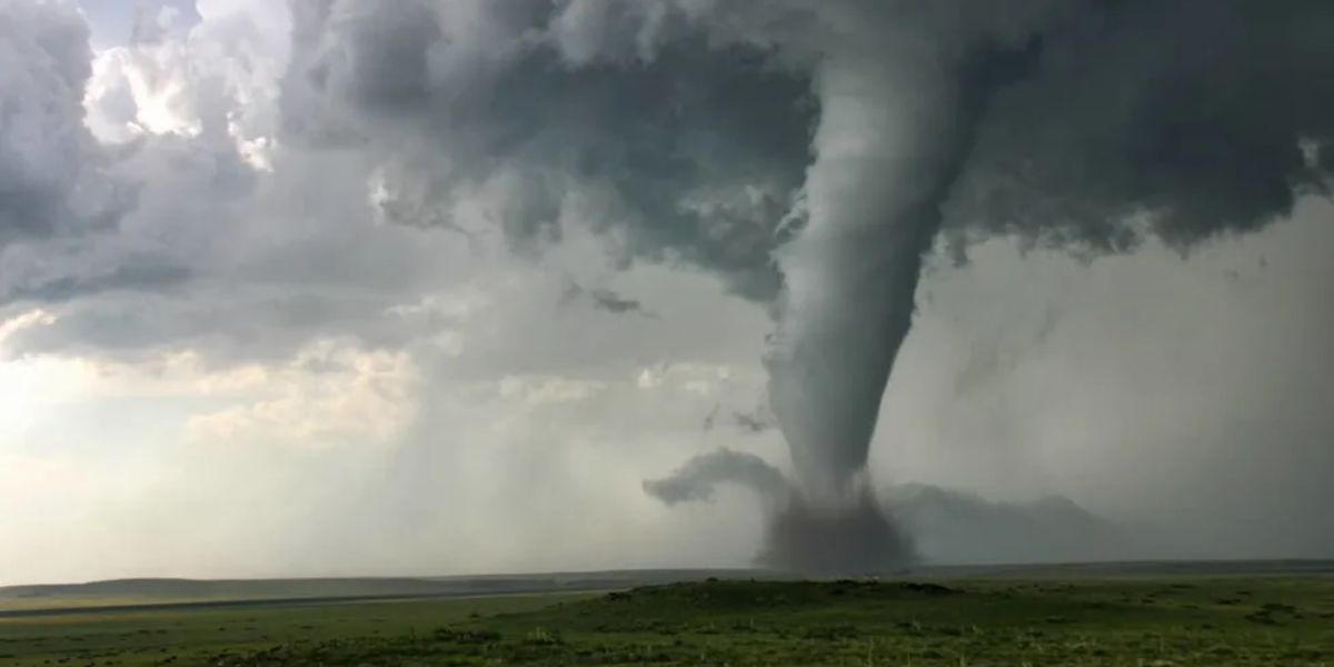
Meteorologists are warning that explosive supercell thunderstorms are expected to fire off the high terrain this afternoon across the Enhanced Risk corridor. These storms carry the potential for baseball-size hail capable of shattering windows and destroying vehicles, violent tornadoes, and damaging wind gusts. Residents in affected areas are being urged to stay off the roads, move vehicles under shelter immediately, and have multiple ways to receive emergency warnings before storms arrive.
Three cities leading the country for best conditions
In sharp contrast, Santa Rosa, California, Clarksville, Tennessee, and Philadelphia, Pennsylvania are among the top-rated spots in the country for weather today. All three cities are experiencing what forecasters describe as true beautiful conditions — clear skies, comfortable temperatures, and ideal outdoor weather. It is the kind of day that rarely gets attention precisely because nothing is going wrong, but the contrast with the active severe weather unfolding across the Plains makes it all the more striking.
Most of the country is in good shape
Beyond the three standout cities, fair to nice conditions stretch across the vast majority of the continental United States on Wednesday — covering most of the Southeast, Mid-Atlantic, Ohio Valley, and Pacific Coast. The single glaring exception remains the Enhanced Risk zone, where the threat is real, imminent, and dangerous.
If you are in Wyoming, Colorado, or Nebraska today, do not wait for the storm to arrive. Act now.