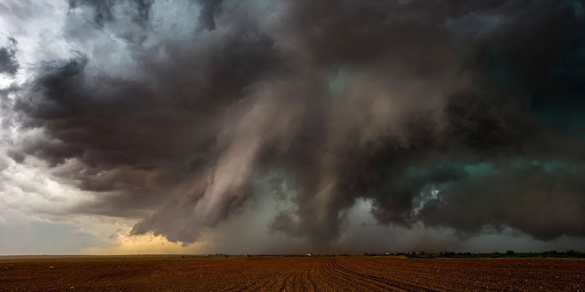
A dangerous and rapidly evolving severe weather outbreak is unfolding across multiple states Tuesday, putting millions of residents from Colorado to the Carolinas at risk of destructive tornadoes, hurricane-force wind gusts, and large, damaging hail as powerful supercell storms fire throughout the afternoon.
Cheyenne Ridge: Ground Zero for Tornadoes
The greatest tornado threat is concentrated near the Cheyenne Ridge in eastern Colorado, where atmospheric conditions are primed for discrete supercell development. Forecasters have issued a 5 percent tornado probability for the area — a figure that signals elevated confidence in the formation of strong, potentially significant tornadoes. Residents in this corridor should not wait to take shelter.
Storms Expected to Merge Into a Destructive Line
What makes today’s threat especially dangerous is the anticipated storm evolution. Afternoon supercells are forecast to congeal into a fast-moving line of storms capable of producing hurricane-force wind gusts across a wide corridor stretching from eastern Colorado through Kansas and deep into Oklahoma. This transition phase — when individual supercells merge into a single squall line — is when the widespread wind destruction potential peaks. Residents across this corridor should prepare for downed trees, power outages, and significant property damage.
Eastern North Carolina and Virginia: Separate Serious Threat
Hundreds of miles to the east, a separate and dangerous wind event is taking shape across eastern North Carolina and Virginia. Forecasters have not ruled out an upgrade to a Level 3 of 5 Enhanced Risk designation for this region as the day progresses. If storm intensity increases as expected, this area could see widespread wind damage rivaling the levels seen in Colorado and Oklahoma. Residents in this region should monitor local alerts closely and have a safety plan ready.
What You Should Do Right Now
If you are in any of the affected areas, move valuables and vehicles to shelter, charge your devices, and identify your nearest safe interior room. Do not wait for a warning to be issued — with storms of this speed and intensity, reaction time will be extremely limited. Stay indoors and away from windows once storms arrive, and do not attempt to drive through flooded or storm-damaged roads.